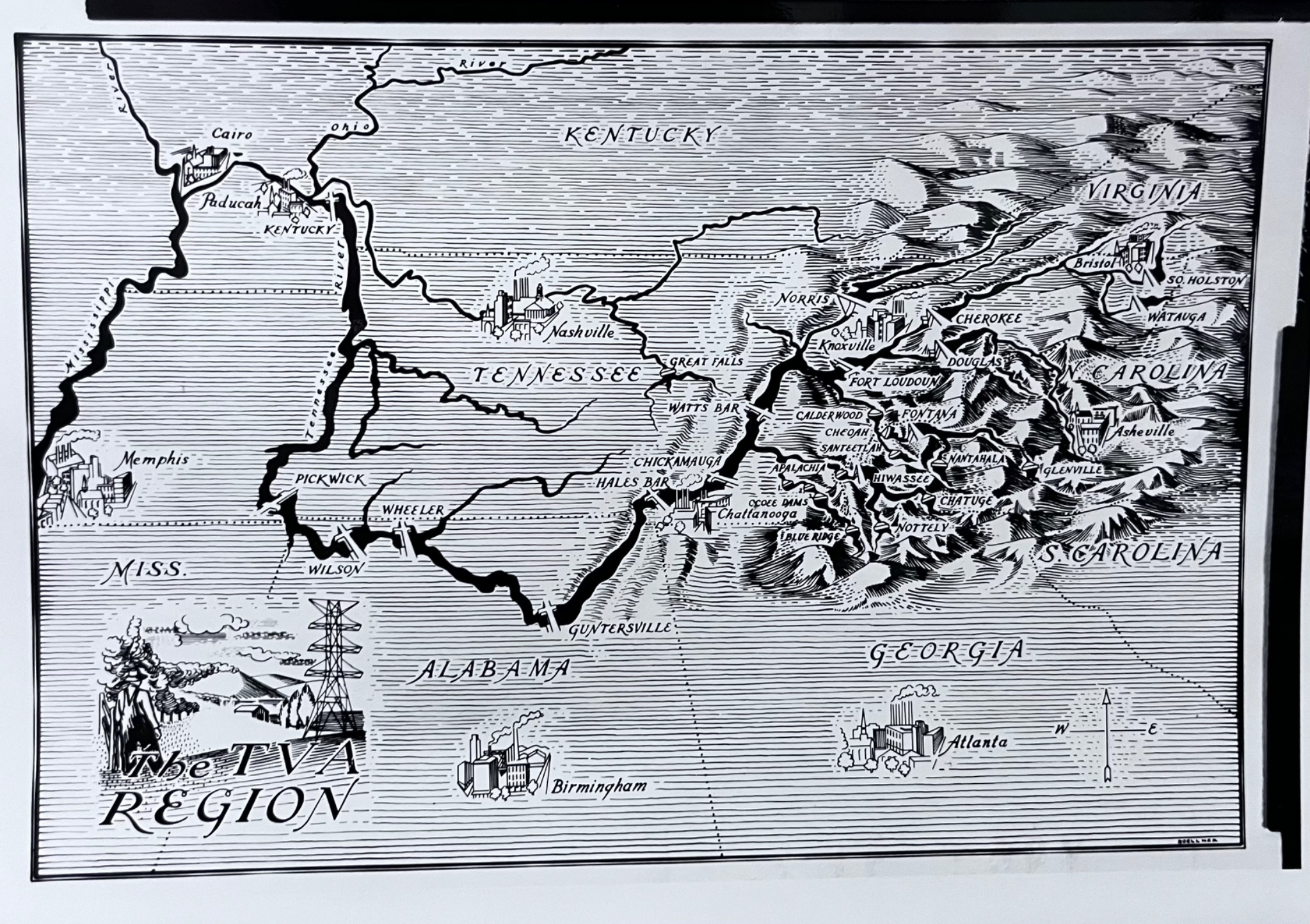
The TVA Region Map
Dublin Core
Title
The TVA Region Map
Subject
TVA regional area of influence
Description
This photo is a black-and-white illustrated map depicting the Tennessee Valley Authority (TVA) region across parts of Tennessee, Kentucky, Alabama, Georgia, North Carolina, and Virginia. The map highlights major cities, rivers, and TVA dam sites. The sketches of various cities highlight the industrialization associated with the TVA, many showing factories. A label on the reverse notes that the eastern portion of the region was more densely populated, industrialized, and polluted than the western section.
Creator
Unknown though likely produced by or for the TVA
Source
University of Tennessee Libraries Special Collections, AR.423, Box 6, Energy, Environment & Resources Center - Photographs, Negatives, & Misc. Publications
Publisher
Likely Tennessee Valley Authority
Date
c. 1945–1955
Contributor
Harry Varley
Rights
Courtesy of the Tennessee Valley Authority
Format
Print photograph of an illustrated map
Language
English
Type
Photo
Identifier
8239-19
Coverage
Tennessee Valley region (Tennessee, Kentucky, Alabama, Georgia, North Carolina, Virginia)
Files
Citation
Unknown though likely produced by or for the TVA, “The TVA Region Map,” Environmental History, accessed November 21, 2026, https://www.environmentalhistory.spring2026.emmaschroeder.net/items/show/17.